Whales and the gulf
Watching whales from the cliffs
You do not need to leave dry land to see whales off Cape Breton. The Cabot Trail runs along cliffs above deep water, and on a calm day a pair of binoculars is enough.
 Photo by Elviroyage; CC BY-SA 4.0 (source file)
- Getting there
- Cabot Trail through Cape Breton Highlands National Park
- Bring
- Binoculars, park pass, a jacket, something to sit on
- At sea
- Flat calm reveals fins and blows from far away; any whitecaps hide them. North-west winds are common in the afternoon on this coast.
- From Chéticamp
- Lookouts begin about 15 minutes north
The western side of Cape Breton Highlands National Park is one of the few places in eastern Canada where a road runs along high cliffs directly above deep, whale-rich water. From the Cabot Trail's lookouts and from short trails off the road, pilot whales, minkes and sometimes larger whales can be seen from land. It costs nothing beyond a park pass, it causes the whales no disturbance, and on a calm day it can be every bit as rewarding as going out on the water.
How shore watching works
Whales spend most of their time underwater. What you are looking for is the short moment when they come up to breathe: a blow, a fin, a back, or a splash. From high ground you can see a much wider area of sea than from a boat, and you can watch for longer without moving. The trade-off is distance. Most of the time the whales will be small shapes far below, and you need to be patient and know what to look for.
Height helps, but so does the shape of the coast. The gulf shore of the Highlands drops steeply into deep water close to land, so whales often pass within a few hundred metres of the cliffs. That is why the stretch between Chéticamp and Pleasant Bay is so well suited to watching from shore.
 Photo by Jared Rover from Toronto, Canada; CC BY-SA 2.0 (source file)
The western lookouts
Just north of the park entrance near Chéticamp, the road follows the coast past a series of pull-offs above the sea. Lookouts such as Cap Rouge and Presqu'ile give wide views north and south over the gulf, and they are easy stops for a few minutes of scanning on the way past. Inland of the road, the short Le Buttereau trail climbs through old Acadian farmland to a viewpoint over the coast towards Petit Étang and Chéticamp.
 Photo by Z3lvs; CC0 1.0 (source file)
Further north the road climbs French Mountain, crosses the plateau and descends MacKenzie Mountain towards Pleasant Bay. Lookouts on the descent give views straight down over the bay. Pleasant Bay itself, with its harbour and nearby headlands, is a good place to finish a day of scanning; the village is covered in Pleasant Bay to Meat Cove.
The Skyline Trail
The best-known whale-watching spot on land in Cape Breton is the headland at the end of the Skyline Trail, high on French Mountain. A level path leads through boreal forest to a boardwalk and stairs that descend the ridge towards the cliff edge, with the gulf spread out on three sides. Pilot whales are often seen from here in summer, and on a calm evening you can sometimes hear them blow from far above.
The trail is popular, especially near sunset, and the parking area can fill up. Stay on the boardwalk: the vegetation on the headland is fragile, and the boardwalk was built to protect it. Moose are common in the area, and you may meet one on the path; give it plenty of space. Sections can close for maintenance or wildlife reasons. The full walk is described in the Skyline Trail guide.
Stay on the boardwalk: the vegetation on the headland is fragile, and the boardwalk was built to protect it.
Further along the coast: Humpbacks of the north coast
What you might see from land
Long-finned pilot whales are the species most often seen from the western cliffs. They travel in groups, so look for several short, hooked black fins surfacing together, often close to shore and sometimes resting at the surface for long spells. Minke whales are the next most likely: a single grey back and a small curved fin that appears briefly and then vanishes, usually with no visible blow. Both are covered in more detail in the guides to pilot whales and to minkes and fin whales.
Larger whales turn up less often but are easier to spot at a distance. A fin whale's tall, narrow blow can hang in the air for several seconds, and a humpback's raised flukes or a breach show as a sudden white burst far out. Harbour porpoises and dolphins pass by too, as do grey and harbour seals, which haul out on rocks below some of the lookouts. Gannets plunging from height are a sign that fish are near the surface, and with them, quite often, whales.
It helps to keep a few notes as you go: the time, the place, which way the animals were heading and how often they surfaced. Patterns emerge quickly. A pod seen heading north in the morning may well pass the next lookout up the road an hour later.
The eastern side
The eastern half of the Cabot Trail faces the open Atlantic rather than the gulf. Whales are seen here too, though less predictably. Lakies Head, north of Ingonish, has a short walk out to rocky viewpoints over the sea, and nearby Green Cove offers a similar perch on pink granite. Minkes and seals are the most likely finds, with seabirds passing close.
 Photo by WabbitWanderer from London, Canada; CC BY-SA 2.0 (source file)
South of the park, the trail runs along St. Ann's Bay. The lookouts here are better for scenery and bald eagles than for whales, but they make a good break on the long drive round. Ingonish and its beaches are covered in Ingonish and Middle Head.
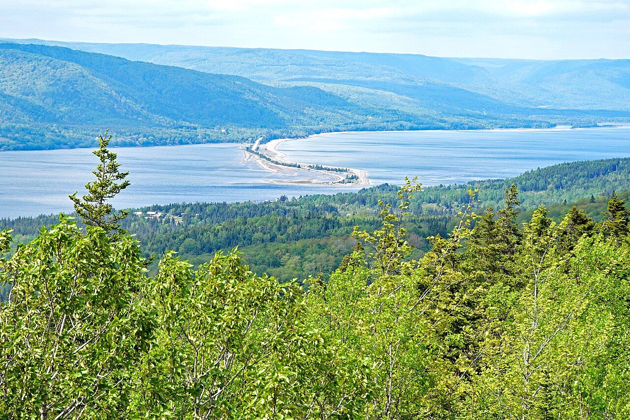 Photo by Dennis G. Jarvis; CC BY-SA 2.0 (source file)
Timing, gear and patience
Calm water is the single most important factor. On a flat sea, a dark fin or a puff of spray stands out clearly; once whitecaps appear, almost nothing can be picked out. Mornings and evenings are often calmer than the middle of the day, and the light is softer. Overcast days with little wind can be excellent, because there is no glare on the water.
Binoculars make the difference between a vague shape and a clear view. A pair around eight or ten times magnification is easy to hold and wide enough to scan with. Scan slowly in strips, rest your eyes now and then, and watch for anything that breaks the rhythm of the waves. Gulls and gannets gathering and diving often mean fish, and fish can mean whales.
Dress for wind even in summer. The cliffs catch every breeze, and an evening on a headland can turn cold quickly. Lookouts and trails inside the national park need a park pass; fees and details change. Above all, give it time. Twenty minutes on a quiet lookout will often show you more than a hurried stop at five.
Finally, keep safety in mind. Many lookouts are on a busy, winding road, so pull fully off the pavement, watch for traffic when you step out, and keep children close to you near cliff edges and barriers. Never climb past fences for a better view: the rock on these headlands can be loose, and a few metres rarely makes any difference to what you see.
Back along the coast: Gulf of St. Lawrence · Further on: Anywhere · Same stretch: Gulf of St. Lawrence, Gulf of St. Lawrence, Pleasant Bay, Gulf of St. Lawrence, Anywhere · the whole coast · logbook